No Warnings, Watches, or Advisories

NWS Central Great Lakes Regional Radar WU East Central Satellite
Radar/Satellite images courtesy of NOAA/NWS and Weather Underground.
spacer
METRIC | IMPERIAL
Updated: 06/08/2026 @ 9:00pm   (0 sec ago)
Temperature Current Conditions Forecast / Storm Prediction
Currently Outside: Colder 1.9°F than last hour.

81.2°F

Heat Index:  86.1°F
Feels like:  86°F
Warm
High Today
88.0°F
2:48 PM
Low Today
62.0°F
6:01 AM
Yest High
87.2°F
6:23 PM
Yest Low
65.4°F
5:47 AM
Sta* High
86.7°F
2021
Sta* Low
43.0°F
2023
* This Station's Records Since 1/2011
Rec* High
102.0°F
1911
Rec* Low
39.0°F
1978
* Records from Weather Underground
Station Record High
Dusk, Dry, Mostly cloudy Dusk, Dry, Mostly cloudy

Calm Wind:  SSW
0.0

Gusting to:
0.0 mph
Current Rain Rain:
0.00 in
Chandler Burning Index: LOW Current CBI
Fire Danger:
2.6 of 100
Tonight

Tonight: Slight Chance Showers And Thunderstorms
Slight Chance Showers And T-Storms
Tuesday

Tuesday: Showers And Thunderstorms
Showers And T-Storms
Tuesday
Night
Tuesday Night: Showers And Thunderstorms
Showers And T-Storms
Lo 69°F Hi 83°F Lo 70°F
SPC Activity Map
Dew Point Liquid Precipitation Wind Speed Sun/Moon
Current: Decreased 0.3°F since last hour. 72.9°F
Last Hour: Decreased 0.3°F since last hour. 0.3°F
High 2:31 PM: 75.6°F
Low 6:54 AM: 58.2°F
Record High: 83.5°F on
Jul-4-2025
Record Low: -40.7°F on
May-14-2018
Wetbulb: 75.5°F
Leaf Wet:7 0
Rain Today
rain graph

Today: 0.00 in
Yesterday: 0.76 in
Last 7 Days: 1.66 in
Jun Rain: 1.66 in
Jun to Date
  Avg:10
0.00 in
Jun to Date
  Diff from Avg:10
Over 1.66 in for the month 1.66 in
Jun Avg: 2.32 in
Diff from Avg: Under 0.66 in for the month 0.66 in
Season:1 16.71 in
YTD
  Avg:11
14.56 in
YTD
  Diff from Avg:11
Over 2.15 in for the year 2.15 in
Last Rain
Time/Date:
Jun-7-2026
at 1:45 AM
75 rain days in 2026
2 days in June
0 days since last rain
Current: SSW  0.0 mph
1Hr Average: Calm
Wind Run: 4.77 miles
Wind Gust
Current: 0.0 mph
Today: 8.1 mph 1:26 PM
Month: 15.0 mph Jun-6
Year: 56.0 mph Feb-11
Record Gust: 56.0 mph
Feb-11-2026
Sunlight:
14 h 41 m 60 s
of Sunlight Yesterday
14 h 42 m 42 s
of Sunlight Today
Which is 42 sec longer than
yesterday
14 h 43 m 20 s
of Sunlight Tomorrow
(Noon ?>) graph (Midnight
Legend

Waning Crescent
Waning Crescent, 23 days, 5 hours, 4 minutes in cycle
43%
Illuminated
Humidity Barometer
Current: Increased 4% since last hour. 76%
Last Hour: Increased 4% since last hour. 4%
High 5:47 AM: 88%
Low 3:29 PM: 57%
Record High: 99%
Jan-22-2017
Record Low: 0%
Mar-4-2022
Current: Falling 0.006  inHg/hr 30.998 inHg
Last Hour: Steady
High 10:11 AM: 31.046
Low 12:04 AM: 30.964
Record High: 31.946 inHg
Apr-23-2022
Record Low: 25.895 inHg
Apr-12-2021
Cooling Degree Days Lightning Strikes Heat Index Air
Today: 3.4
Jun: 33.6
2026 to Date: 129.4
Heating Degree Days
2026 to Date: 2954.0
Last Min: 0
Last 5 Mins: 0
Last 30 Mins: 0
Last 60 Mins: 0
Last 12 Hrs: 0
Jun: 2348
2026 to Date: 9948
Current: 86.1°F
High 2:43pm: 97.3°F
Yesterday: 93.9°F
Record: 127.2°F
Jun-2-2023
Quality
Index6:

66


Moderate
Density:
1.20 kg/m3
UV Summary/Forecast Solar Summary
High Today:   3.4 @ 2:16 PM
Jun-09

8.6
Jun-10

9.5
Jun-11

9.6
High Today:  
445 W/m2 @ 3:22 PM
Sun Hours Today:
00:00
   This Month: 02:19 Hrs
Rise: 6:01 am  Set: 8:58 pm
Soil Conditions8 Irrigation Index5 Station All Time Records Cloud Level
2.4 in: 3.0 cb | 66°F
1.6 in: 4.0 cb | 67°F
0.8 in: 5.0 cb | 69°F
0.2 in: 6.0 cb | 71°F

Growing conditions
at the depth of:  0.2 in:


Soil moisture range is from
0-Wet to 200-Dry/Frozen
Updated at Midnight
Current ET: 0.09 in
7-Days Rain: 1.66 in
7-Days ET: 0.41 in
7-Day:  1.247 in water in excess of what evaporated in last 7 days. 1.247 in
June:  1.24 in water in excess of what evaporated this month. 1.24 in
HIGHS: LOWS:
99.5°F
Jun-21-2022
-12.5°F
Jan-31-2026
Daytime Records
  95.0°F°F
Jun-24-2025
  -2.6°F°F
Jan-30-2019
Nitetime Records
  84.2°F°F
Jun-23-2024
  -6.3°F°F
Jan-01-2018
ICN:13 | S3C2:4 | Ajax 3.xx
ISS:Ok | CON:4.7 | RCP:98%
METRIC | IMPERIAL
Updated: 06/08/2026 @ 9:00pm  
1 Rain season: Jan 1st to Dec 31st.   2 Snow season July 1st to June 30th.   3 Snow manually measured usually around 7AM and 7PM.   5 Estimated amount of water needed to replace the water used by plants and evaporation from the past week. (Negative numbers mean amount of water needed, positive numbers mean excess water is present).   6 Air Quality Index is provided by Minnesota Polution Control Agency and is updated hourly between the hours of 6AM and Midnight.   7 Leaf Wetness is surface moisture on foliage. 0 being totally dry and 15 being totally saturated.   8 Soil moisture and temperatures are from sensors burried in the ground at the levels specified.   10 Historical average only to day 8 of just the month of June for this station since 2011.   11 Historical average rain this season to day 8 of June for this station since 2011.
 NWS Weather Forecast  -   Outlook Tonight & Tuesday
Tonight

Tonight: Slight Chance Showers And Thunderstorms
Slight Chance Showers And T-Storms

Lo 69°F
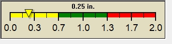
NWS forecast: A slight chance of showers and thunderstorms between 7pm and 2am, then a chance of showers and thunderstorms. Cloudy, with a low around 69. South wind 1 to 7 mph. Chance of precipitation is 50%. New rainfall amounts less than a tenth of an inch possible.
Local station forecast: Increasing clouds with little temp change, precipitation possible within 24 to 48 hrs.
Tuesday

Tuesday: Showers And Thunderstorms
Showers And T-Storms

Hi 83°F
NWS forecast: A chance of rain showers before 11am, then showers and thunderstorms. Mostly cloudy, with a high near 83. South wind 5 to 13 mph, with gusts as high as 23 mph. Chance of precipitation is 100%. New rainfall amounts between a half and three quarters of an inch possible.
 NWS Short Term Weather Forecast
Tuesday
Night
Tuesday Night: Showers And Thunderstorms
Showers And T-Storms
Wednesday

Wednesday: Chance Showers And Thunderstorms then Showers And Thunderstorms
Chance Showers And T-Storms then Showers And T-Storms
Wednesday
Night
Wednesday Night: Chance Showers And Thunderstorms then Partly Cloudy
Chance Showers And T-Storms then Partly Cloudy
Thursday

Thursday: Chance Showers And Thunderstorms
Chance Showers And T-Storms
Thursday
Night
Thursday Night: Showers And Thunderstorms Likely then Chance Showers And Thunderstorms
Showers And T-Storms Likely then Chance Showers And T-Storms
Friday

Friday: Showers And Thunderstorms Likely
Showers And T-Storms Likely
Friday
Night
Friday Night: Showers And Thunderstorms Likely then Partly Cloudy
Showers And T-Storms Likely then Partly Cloudy
Lo 70°F Hi 86°F Lo 71°F Hi 90°F Lo 72°F Hi 85°F Lo 60°F
Script by: Scott of BurnsvilleWeatherLIVE.com
Now supported by Saratoga-weather.org Download